As tropical storm Chantal hovered over the Caribbean this week, our East Coast readers got a not-so-friendly reminder that hurricane season started on June 1. Many eyes will be glued to the weather maps this year, in preparation for—and in trepidation of—a severe storm that could threaten the beaches, homes and businesses just rebuilt after 2012’s Hurricane Sandy.
With that in mind, , the U.S. Energy Information Administration (EIA) is introducing interactive maps that combine real-time data feeds from the National Hurricane Center—with more than 20 map layers showing the nation's energy infrastructure and resources.
This new tool, available 24/7 on the EIA website, will help the utility industry, energy analysts, government decision makers and the American public better see and understand the potential impact of a storm.
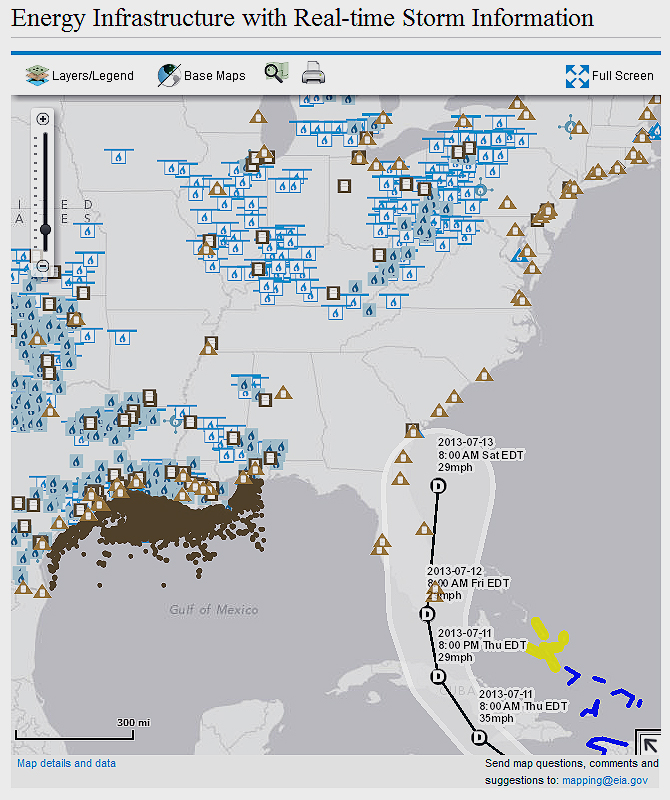
Above, the EIA real-time storm map, showing the path of tropical storm Chantal on July 7, as well as the U.S. energy infrastructure (pipelines, underground storage facilities, oil platforms in federal waters, refineries, power plants, and more).
"This new mapping capability combines detailed energy infrastructure information with real-time tropical storm information from the National Hurricane Center," said EIA Administrator Adam Sieminski. "This is a great example of technology providing better service to the American public."
Every year, hurricanes and other extreme weather events threaten life and property. Hurricanes also affect the nation's energy infrastructure, especially when storm paths traverse offshore production rigs and pipelines in the Gulf of Mexico, coastal refineries, power plants, and energy import and export sites.
The new maps are at http://www.eia.gov/special/disruptions/. Right now, the public can see the predicted path of tropical storm Chantal, as “she” moves from the Caribbean's Leeward Islands toward the Atlantic coast of Florida. As the National Hurricane Center revises its predictions, the maps will be instantly updated.
Edited by Rachel Ramsey
 Internet Telephony Magazine
Click here to read latest issue
Internet Telephony Magazine
Click here to read latest issue CUSTOMER
  Cloud Computing Magazine
Click here to read latest issue
Cloud Computing Magazine
Click here to read latest issue IoT EVOLUTION MAGAZINE


